GIS consultancy and development
Terrain Technologies provides a wide range of GIS consultancy services to both public and private firms, developing projects and applications related to several fields: transportation, environment, infrastructure development, telecommunications, healthcare, etc.
Spatial analysis
Datasets are often complex with multiple tables and values. Spatial data analysis is used to study raw or processed data so that the patterns within the data can be easily interpreted. The type of spatial analysis required will depend upon the question that you wish to answer and the raw or processed data to be analysed. Some examples of questions which could be answered using spatial analysis include:
Which factors affect species in an specific environment?
Where is the best location to build a new mall or park?
How many people do not have access to services?
How does accessibility of services vary?

Some types of spatial analysis offered by Terrain Technologies:
Network analysis
studies a full netork (transportation, electricity, water, etc.) in order to find the fastest or shortest path among points. It is possible to apply the analysis to different situations, e.g.: determine a hospital, school or emergency services areas, etc.. If available, this information can be combined with census data.
Statistical analysis
Is useful in analysing large volumes of data in order to find correlations between variables, generating prediction models of values that are valid in other locations. Regression is one of the statistical methods used to find existing spatial patterns in data.
Terrain analysis
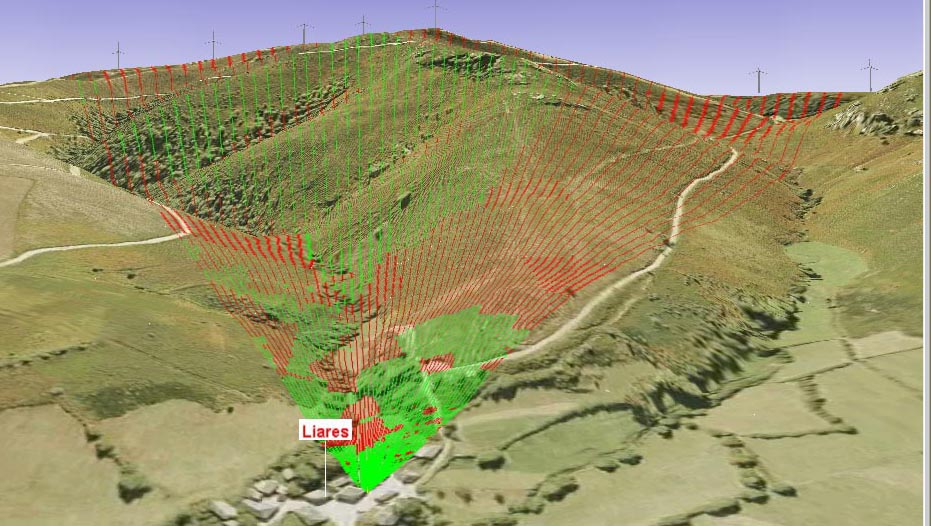
3D information is analyzed (DTM, contour lines, etc.) in order to calculate slopes, aspects and relief. Can be used to calculate the visual impact of a new development (e.g. a new highway), but also to calculate flood or fire risks in a specific area.
Data capture, management and verification
We import data from different sources (hardcopy or scanned), aerial images, vector
data (georeferenced or not). We analyze the information in order to determine the most efficient
methodology for data capture and assure the scale and accuracy needed to meet the client
requirements.
Data is then processed and verified, correcting possible errors derived from mixing data from
different scales and/or projections, fixing spatial and attribute errors, etc.
Geographical data processing
Terrain Technologies provides a full range of geographic data processing, including:
Seamless layer creation
after integrating different raster data we create seamless layers, according to the client's needs.
Generalization
we process complex layers in order to simplify the existing geometry and/or the attribute data. Results are easy to handle by non-technical users.
MDT
We process digital terrain models, creating different layers that can be interpreted in a visual way, or using spatial analysis.
GIS Application development
Terrain Technologies develops application that allow GIS components integration with virtually any other development, facilitating the access to spatial analysis to non-technical users, automatize tasks, validata input data, etc.