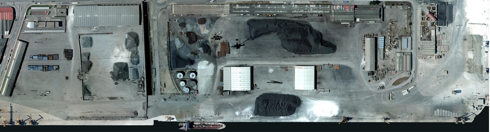
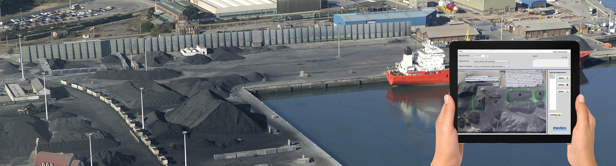
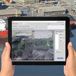
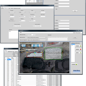
MEDEA supports measuring and control
processes in port areas occupied by bulk and other solid goods. Replaces traditional
manual methodologies by using aerial georeferenced images (orthophotos) with an
application providing measuring and administration tools, connecting with and
updating Port databases. Supports queries of all existing deposits by zone, ship,
good, client or date ranges, while providing visualization and edition of existing
deposits.
It has been developed with the collaboration of the University of
Oviedo and the
Port of Avilés (Spain), who requested the technological development
and established
the functions and paramenters MEDEA must include.
Advantages
Provides important advantages aimed at improving competitiveness:
Workplace safety
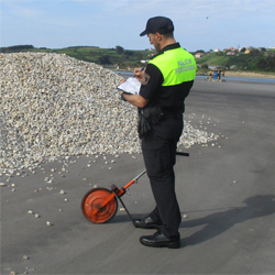
Increases workplace safety by reducing the time Port employees spend moving in Port operation areas.
Cost reduction
Sustancial reduction in times needed to measure areas occupied by bulk and other solid goods.
Traceability
Guarantees measurement traceability, improving protection against client's complaints using a visual database of aerial images covering all dock area.
Other features
Environment monitoring; load/unload operation control and surveillance, etc